


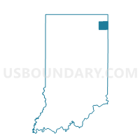
WILMINGTON 4, DeKalb County, Indiana
About
Outline

Summary
| Unique Area Identifier | 576843 |
| Name | WILMINGTON 4 |
| County | DeKalb County |
| State | Indiana |
| Area (square miles) | 33.88 |
| Land Area (square miles) | 33.88 |
| Water Area (square miles) | 0.01 |
| % of Land Area | 99.98 |
| % of Water Area | 0.02 |
| Latitude of the Internal Point | 41.39799000 |
| Longtitude of the Internal Point | -84.91406540 |
Maps


Graphs
Select a template below for downloading or customizing gragh for WILMINGTON 4, DeKalb County, Indiana


Neighbors
Neighoring Voting District (by Name) Neighboring Voting District on the Map
- CONCORD, DeKalb County, IN
- FRANKLIN, DeKalb County, IN
- GRANT 2, DeKalb County, IN
- JACKSON NORTH, DeKalb County, IN
- NEWVILLE, DeKalb County, IN
- SMITHFIELD EAST, DeKalb County, IN
- STAFFORD, DeKalb County, IN
- TROY, DeKalb County, IN
- UNION 9, DeKalb County, IN
- WILMINGTON 1, DeKalb County, IN
- WILMINGTON 2, DeKalb County, IN
- WILMINGTON 3, DeKalb County, IN
Top 10 Neighboring County Subdivision (by Population) Neighboring County Subdivision on the Map
- Union township, DeKalb County, IN (13,220)
- Wilmington township, DeKalb County, IN (4,128)
- Grant township, DeKalb County, IN (3,245)
- Jackson township, DeKalb County, IN (3,064)
- Smithfield township, DeKalb County, IN (1,613)
- Concord township, DeKalb County, IN (1,335)
- Franklin township, DeKalb County, IN (1,182)
- Newville township, DeKalb County, IN (558)
- Troy township, DeKalb County, IN (304)
- Stafford township, DeKalb County, IN (283)
Top 10 Neighboring Place (by Population) Neighboring Place on the Map
Top 10 Neighboring Unified School District (by Population) Neighboring Unified School District on the Map
- DeKalb County Central United School District, IN (24,173)
- DeKalb County Eastern Community School District, IN (7,841)
- Hamilton Community Schools, IN (4,327)
Top 10 Neighboring State Legislative District Lower Chamber (by Population) Neighboring State Legislative District Lower Chamber on the Map
Top 10 Neighboring State Legislative District Upper Chamber (by Population) Neighboring State Legislative District Upper Chamber on the Map
Top 10 Neighboring 111th Congressional District (by Population) Neighboring 111th Congressional District on the Map
Top 10 Neighboring Census Tract (by Population) Neighboring Census Tract on the Map
- Census Tract 204, DeKalb County, IN (7,211)
- Census Tract 202, DeKalb County, IN (4,608)
- Census Tract 201, DeKalb County, IN (4,428)
- Census Tract 203, DeKalb County, IN (4,302)
- Census Tract 208, DeKalb County, IN (4,280)